
PLEASE NOTE- You may experience weather related delays as Hurricane Michael is expected to make landfall in the Florida Panhandle area Wednesday night, October 10th.
Thank you for understanding and your continued support.
If you have any questions please feel free to contact Customer Service at (310)338-9333 or e-mail us at cs@stitrans.com.
Updates as of 10/11 3:00 P.M. (PT)
Hurricane Michael carved swaths of devastation as it made landfall on the Florida Panhandle.
Updates as of 10/10 5:00 P.M. (PT)
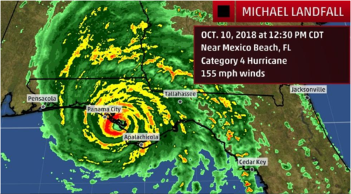
Michael made landfall near Mexico Beach, Florida, early Wednesday afternoon.
Updates as of 10/10 8:53 A.M. (PT)
Updates as of 10/09 2:35 P.M. (PT)
Source: The Weather Channel
Last Updated: 10/10 5:00 P.M. (PT)
Image Source: The Weather Channel
Last Updated: 10/10 5:00 P.M. (PT)
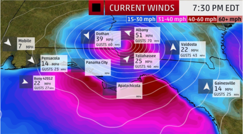
Image Source: The Weather Channel
Last Updated: 10/10 5:00 P.M. (PT)
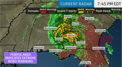
Image Source: The Weather Channel